The Murray–Darling is the sort of name that arrives already exhausted. Strip the noise back and it is still a physical fact: rain that falls on a seventh of the continent is asked to become river, crop, town supply, wetland and, in a dry year, the water in an Adelaide kettle.
A catchment the size of a country
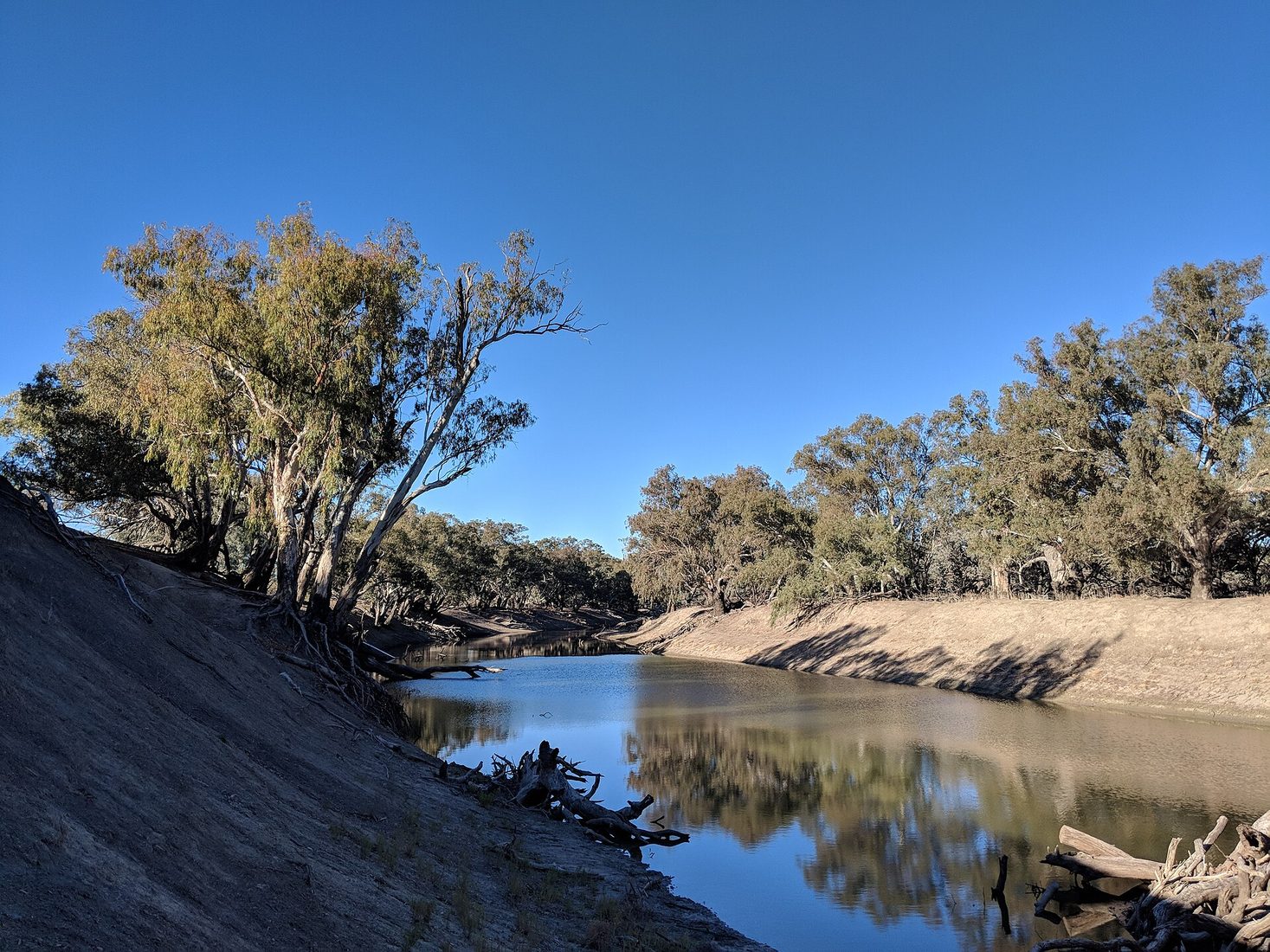
The Basin is not one river. It is a family of rivers that eventually agree to meet. The Darling and its northern cousins — the Condamine–Balonne, the Macintyre, the Gwydir, the Namoi, the Macquarie, the Warrego — drain inland Queensland and northern New South Wales across country that is mostly flat and often mean with rain. The southern system is wetter in a conventional sense: the Murray, the Murrumbidgee, the Goulburn, the Loddon, the Campaspe, fed by the Snowy Mountains and the Victorian high country. The two systems join near Wentworth. From there the Murray carries the combined story west, past Mildura and Renmark, to the Coorong and the sea.
South Australia sits at the end of the queue. Geography is not a negotiating position, though it is often asked to behave like one. The Basin covers more than a million square kilometres, about fourteen per cent of Australia. It grows a third of the country's food. It also holds towns that do not appear in the national weather graphic until something fails: Menindee, Wilcannia, Bourke, Waikerie, Swan Hill. Queensland, New South Wales, Victoria, South Australia and the Australian Capital Territory all take water under rules rewritten after the Millennium Drought taught a generation that “average rainfall” is a polite fiction.
If you want a second underground story beside this one, the Great Artesian Basin is the other hidden ledger of inland Australia. Rivers you can see and aquifers you cannot are not the same patient, but they share a habit of being spent faster than they are replaced.
Irrigation, towns and the long argument
In the north, a river rise is often a pulse. In the south, storages — Dartmouth, Hume, Eildon, Burrinjuck, Blowering — hold that pulse and release it on a calendar. Dams do not create water. They move it through time.
Irrigation is not a villain in a children's play. It is how grapes grow at Mildura, how dairy survived in northern Victoria, how almonds marched west, how cotton became a northern industry that can, in a good year, look like a manufactured sea. It is also how a floodplain forest learns to wait. The argument is not whether people should farm. It is how much of a shared river a farm, a town and a reed bed can each take before the shared thing stops being shared.
Towns use less water than agriculture. That is true and incomplete. A town cannot fallow itself for a season. Broken Hill cannot tell the hospital to wait for an allocation announcement. Adelaide cannot put the Mount Lofty storages on a prayer and call it a plan. Urban demand is small as a percentage and absolute as a political fact.
There is a household version of the same geometry. A suburban creek in Melbourne or western Sydney is not the Murray, but it is the same idea at walking distance: water that used to soak, now rushed, now argued over. We wrote about that smaller cousin in urban creeks and the stormwater we pretend is gone. The Basin is the national edition of a local habit.
The Basin Plan in kitchen language
The Murray–Darling Basin Plan, agreed in 2012 after a decade of drought and a great deal of shouting, tried to say how much water could be taken from the system each year, on average, without the rivers and the lower lakes becoming a permanent emergency. The number that stuck in public memory was 2,750 gigalitres — water to be recovered for the environment, against a history of over-allocation. Later politics trimmed, delayed and redesigned parts of that recovery. The number is less important to a householder than the idea: there is a limit, the limit is contested, and the contest is not over.
Someone has to keep the books. They were cooked for a long time, often by optimism and a belief that the next year would be wetter. The Plan tries to stop writing cheques on rain that has not fallen, without emptying regional towns. A householder in a capital city is allowed to find the reviews tiresome. They are not allowed to find them irrelevant.
The wider shelf lives in The Water: tanks, artesian country, creeks, the garden hose in a restriction summer. The Basin is the large print.
Why Adelaide and Broken Hill are in the story
Adelaide draws a share of its drinking water from the Murray, especially when the Mount Lofty Ranges have had a poor winter. In a dry sequence the river is not a picturesque extra. It is the difference between a city that can keep the taps on and a city that must lean harder on desalination. Desalination is a machine with costs. The river, when it is healthy enough to share, is still the older option.
Broken Hill used to depend on the Menindee Lakes, a shallow, evaporating system on the Darling that has been a drought emblem for twenty years. The pipeline from the Murray near Wentworth was built so a mining town in the far west of New South Wales would not have to gamble its drinking water on a river that now arrives as an event rather than a season. That pipeline is engineering and a quiet admission. The Darling, as a reliable town supply, had become a hope.
A householder in either place does not need to recite gigalitres. They need to know that decisions made on a cotton farm near St George, or in a storage release from Hume, or in a meeting about floodplain harvesting, can show up as a restriction notice, a higher bill, or a taste in the glass. Salinity, algal blooms and the chemistry of a low, warm weir pool are household facts.
Fish kills, buybacks and the leftover water
The fish kills at Menindee — 2018–19, then again in 2023 — looked like a sudden cruelty. They were a slow one that became visible. Golden perch, bony herring, Murray cod piled at the water's edge. The immediate mechanism is often hypoxia: water with too little oxygen for a fish to keep its life. The causes stack. A heatwave. A drop in flow that concentrates fish in a shrinking pool. A pulse of leaf litter into a warm channel — blackwater. Blue-green algae in still, nutrient-rich water. Weirs that stop fish leaving when they need to leave.
It requires a river that has been simplified, warmed and asked to run on a human timetable. The useful response is reconnecting floodplains and keeping enough water in the channel through summer.
Two methods have been sold as the way to find water for the river. The first is buyback: government purchases a water entitlement from a willing seller. The water that used to be legally taken stays in the environmental account. It is blunt, relatively transparent, and politically radioactive in towns that watch a pump go quiet.
The second is efficiency. Line a channel. Replace a flood bay with drip. The water that used to leak or evaporate is counted as a saving, and a share is meant to go back to the river. On a spreadsheet this is elegant. In a landscape it is more complicated. Some of the “lost” water was never lost. It was seepage that became a wetland, a creek, a neighbour's shallow bore. Efficiency can dry the leftover landscape while the farm looks modern and the recovery target looks met.
A householder should know that “no one loses water” usually means someone out of frame has lost a flood. Buybacks have social costs. Efficiency has hydrological costs. Floodplain harvesting in the north was, for a long time, the least documented large take in the system.
The continent does not have spare catchments. The Murray–Darling is the one we already spent. Looking after it is not a mood. It is bookkeeping, habitat, and the unfashionable belief that a river should still be able to finish its sentence at the sea.